

Building Coastal Resilience in Georgian Bay: Integrated Modeling and AI Tools for Extreme Water Levels, Flooding, and Coastal Erosion
01/07/2026 - 30/06/2031
Georgian Bay is increasingly vulnerable to climate-driven extremes, including record-high water levels, stronger storms, reduced ice cover, and accelerated shoreline erosion. These changes threaten coastal communities, critical infrastructure, wetlands, and ecologically significant shorelines. This project will develop an integrated coastal resilience assessment system for Georgian Bay that combines advanced hydrodynamic modeling, wave and sediment transport simulations, and artificial intelligence (AI)– based hazard prediction tools. Using a coupled modeling framework, the project will quantify extreme water levels, storm-driven flooding, wave impacts, and shoreline erosion across Georgian Bay. High-resolution simulations will identify erosion hotspots, vulnerable shorelines, and areas at greatest long-term risk under present and future climate conditions. To enhance accessibility and decision-making speed, AI-driven emulators will be trained on physics-based model outputs to enable rapid screening of coastal hazards without the need for time-intensive simulations. The results will be delivered as actionable datasets, maps, and decision-support tools to GBF and its partners, supporting shoreline stewardship, habitat protection, and climate adaptation planning. Community engagement is an integral component of the project, with opportunities for local knowledge and observations to complement scientific modeling. By integrating rigorous science with userfriendly tools, this project will help communities, conservation organizations, and First Nations better anticipate and respond to emerging coastal risks, strengthening long-term resilience while safeguarding Georgian Bay’s natural and ecological heritage for future generations.
Major Environmental Issue
Coastal Vulnerability
Georgian Bay is facing increasing coastal vulnerability driven by climate-related extreme water levels, intensified storm events, reduced ice cover, and high-energy wave activity, resulting in heightened risks of coastal inundation, shoreline erosion, habitat degradation, and impacts to coastal communities and infrastructure.
Project Objectives
The general objective of this project is to develop an integrated, science-based coastal resilience assessment system for Georgian Bay that quantifies climate-driven extreme water levels, coastal inundation, wave impacts, shoreline mobility, and erosion hotspots, and translates this information into actionable datasets and decision-support tools to support climate adaptation planning, shoreline stewardship, and ecosystem protection.

Sustainability & Long-Term Impact
1
Long-Term Stewardship Plan
Project datasets, maps, and decision-support tools will be retained and used by GBF to support ongoing shoreline stewardship and climate adaptation planning beyond the project period. The long-term stewardship value of this project lies in its ability to provide durable, transferable, and decision-ready information that GBF and its partners can continue to use beyond the project period.
2
Maintenance/Monitoring Commitments
This project is designed to minimize long-term maintenance burdens while maximizing the durability and usability of project outputs. All geospatial hazard layers, erosion hotspot maps, return-level datasets, and documentation will be delivered in standard, nonproprietary GIS formats with clear metadata, enabling GBF to store, manage, and reuse the products using existing platforms and workflows. The project team will provide final documentation and guidance describing data structures, assumptions, and recommended update pathways, allowing future revisions or extensions as new observational data, climate scenarios, or stewardship priorities emerge. While the project does not include long-term operational monitoring or continuous model updates beyond the two-year funding period, the analytical framework and workflows are intentionally designed to support periodic re-analysis or follow-on studies by GBF partners, agencies, or academic collaborators.
3
Capacity-Building/Knowledge Transfer
The project will build capacity by providing GBF with accessible geospatial datasets and hazard maps, along with technical documentation to support shoreline stewardship and climate adaptation planning. Knowledge transfer will focus on enabling GBF to confidently apply project outputs in planning, communication, and engagement activities beyond the project period. Capacity-building activities will include structured briefings and hands-on demonstrations with GBF staff to explain the interpretation and appropriate use of geospatial hazard layers, erosion hotspot maps, and return-level estimates. The project will also facilitate knowledge transfer to broader stakeholder groups through GBF-led workshops and outreach materials that translate complex coastal hazard information into accessible formats for local communities. This approach supports lasting capacity for evidence-based coastal management and strengthens the region’s ability to respond proactively to future climate-driven coastal risks.
Expected Outcomes
01
Improved understanding of climate-driven coastal inundation and shoreline erosion risks across Georgian Bay, including the roles of extreme water levels, storms, waves, and changing ice conditions.
02
Quantitative estimates of extreme water-level and coastal inundation risk, including return-level estimates (e.g., 10-, 25-, 50-, and 100-year events) under present and future climate conditions.
03
Identification of vulnerable shorelines and selected erosion hotspot, providing erosion information under present and future climate conditions to support proactive shoreline stewardship and conservation planning.
04
GIS-ready geospatial hazard layers, including coastal inundation, wave exposure, erosion hotspots, and shoreline vulnerability, designed for direct integration into GBF’s mapping, communication, and decision-support platforms.
05
A technical report documenting modeling methods, hazard drivers, key findings, and climate-change implications, providing transparent and durable scientific support for management and outreach activities.


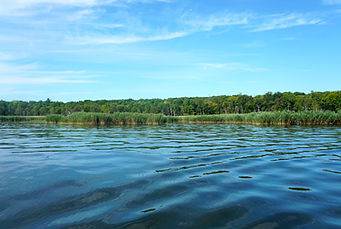

Goals in Line with Georgian Bay Forever's Mission
This project directly advances GBF’s mission to protect, enhance, and restore the aquatic ecosystem of Georgian Bay through science, research, education, and community action, helping ensure the Bay remains healthy for future generations. By delivering rigorous, science-based assessments of climatedriven extreme water levels, coastal inundation, wave exposure, and shoreline erosion, the project provides essential knowledge to safeguard the Bay’s waters, wetlands, and ecologically significant shorelines.
The integrated modeling framework and geospatial products developed through this work will equip GBF and its partners with actionable, decision-ready tools to anticipate and mitigate emerging climate hazards, prioritize shoreline stewardship and restoration efforts, and support evidence-based adaptation planning. By enabling clearer communication of coastal risks to local communities, the project strengthens community resilience and supports GBF’s long-term commitment to preserving a healthy, resilient, and thriving Georgian Bay in the face of accelerating climate change.
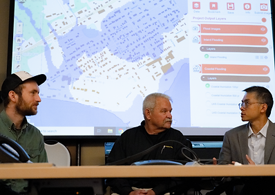
Pengfei Xue
Principal Investigator
Associate Director, Great Lakes Research Center
Professor, Civil, Environmental, and Geospatial Engineering
Director, Center for Environmental Engineering, Sensing, and Integrated Modeling
Michigan Technological University
-
PhD, University of Massachusetts Intercampus Marine Science Graduate Program
-
BS, Mathematics and Applied Mathematics, East China Normal University
Dr. Pengfei Xue (MTU) is the Project Lead and an expert in Great Lakes hydrodynamics, regional climate modeling, and ML-enhanced environmental prediction. His research team develops high-resolution FVCOM-based and coupled atmosphere–lake modeling systems widely used in the Great Lakes to assess flooding, extreme water levels, ice dynamics, and climate change impacts. He leads overall model development, integration, and scientific synthesis for the project. Dr. Xue has authored over 50 peer-reviewed publications on the Great Lakes system and has led projects supported by NSF, NOAA, NASA, USGS, DOE, and EPA
.jpg)